
La Jolla
La Jolla
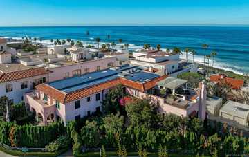
La Jolla is an affluent neighborhood in San Diego, California. It is a hilly seasidecommunity, occupying 7 miles (11 km) of curving coastline along the Pacific Ocean within the northern city limits. La Jolla had the highest home prices in the nation in 2008 and 2009; the average price of a standardized four-bedroom home in La Jolla was reported as US $1.842 million in 2008 and US $2.125 million in 2009.The 2004 estimated population of the 92037 ZIP code was 42,808 while the La Jolla community planning area had an estimated population of 31,746 in 2010. La Jolla is surrounded on three sides by ocean bluffs and beaches and is located 12 miles (19 km) north of Downtown San Diego, and 40 miles (64 km) south of Orange County California, The climate is mild, with an average daily temperature of 70.5 °F (21.4 °C) La Jolla is home to a variety of businesses in the areas of lodging, dining, shopping, software, finance, real estate, bio-engineering, medical practice and scientific research.
The University of California, San Diego (UCSD) is located in La Jolla, as are the Salk Institute, Scripps Institution of Oceanography, Scripps Research Institute, and the headquarters of National University (though its academic campuses are elsewhere).
Neighborhoods
- La Jolla Farms – This northern La Jolla neighborhood is just west of UCSD. It includes the Torrey Pines Gliderport, the Salk Institute, and a group of expensive homes on the cliffs above Black’s Beach.
- La Jolla Shores – The residential area and the Scripps Institution of Oceanography campus along La Jolla Shores Beach and east up the hillside. Also includes a small business district of shops and restaurants along Avenida de la Playa.
- La Jolla Heights – The homes on the hills overlooking La Jolla Shores. No businesses.
- Hidden Valley – Lower portion of Mount Soledad on the northern slopes. No businesses.
- Country Club – Lower Mt. Soledad on the northwest side, including the La Jolla Country Club golf course.
- Village – Also called Village of La Jolla (not to be confused with La Jolla Village) the “downtown” business district area, including most of La Jolla’s shops and restaurants, and the immediately surrounding higher density and single family residential areas.
- Beach-Barber Tract – The coastal section from Windansea Beach to the Village. A few shops and restaurants along La Jolla Boulevard.
- Lower Hermosa – Coastal strip south of Beach-Barber Tract. No businesses.
- Bird Rock – Southern coastal La Jolla, and the very lowest slopes of Mt. Soledad in the area. Notable for shops and restaurants along La Jolla Boulevard, five traffic roundabouts on La Jolla Boulevard, coastal bluffs, and surfing areas just two blocks off the main drag.
- Muirlands – Relatively large area on western middle slope of Mt. Soledad. No businesses.
- La Jolla Mesa – A strip on the lower southern side of Mt. Soledad, bordering Pacific Beach. No businesses.
- La Jolla Alta – A master planned development east of La Jolla Mesa. No businesses.
- Soledad South – Southeastern slopes of Mt. Soledad, all the way up to the top, east of La Jolla Alta.
- Muirlands West – The small neighborhood between Muirlands to the south, and Country Club to the north. No businesses.
- Upper Hermosa – Southwestern La Jolla, north of Bird Rock and east of La Jolla Blvd.
- La Jolla Village – Not to be confused with the Village (of La Jolla). In northeast La Jolla, east of La Jolla Heights, west of I-5 and south of UCSD. The neighborhood’s namesake is the La Jolla Village Square shopping and residential mall, which includes two movie theaters.
From Wikipedia, the free encyclopedia
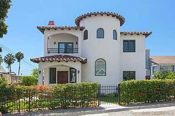
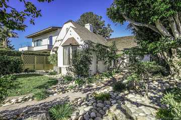
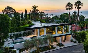
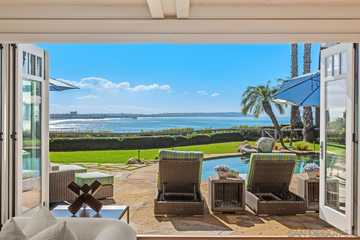
Homes for Sale in La Jolla

$4,095,000
MLS# 240004620
5628 La Jolla Blvd
La Jolla, CA 92037
La Jolla, CA 92037
Property Type:
Detached
Offered by:
Next Wave Commercial Real Estate, Inc.
$3,195,000
Open House
MLS# 240004624
5622 Taft Avenue
La Jolla, CA 92037
La Jolla, CA 92037
Property Type:
Detached
Offered by:
Coldwell Banker Realty

$3,650,000
MLS# 240004514
6325 Via Maria
La Jolla, CA 92037
La Jolla, CA 92037
Property Type:
Detached
Offered by:
Berkshire Hathaway HomeServices California Properties

$2,000,000
Open House
MLS# 240004332
795 Bonair Pl
La Jolla, CA 92037
La Jolla, CA 92037
Property Type:
Attached
Offered by:
Big Block Realty, Inc.
$3,395,000
$7,950,000
MLS# 240004090
7837 Lookout Drive
San Diego, CA 92037
San Diego, CA 92037
Property Type:
Detached
Offered by:
Berkshire Hathaway HomeServices California Properties

$9,950,000
MLS# 240004020
1718 Valdes Dr
La Jolla, CA 92037
La Jolla, CA 92037
Property Type:
Detached
Offered by:
Douglas Elliman of California, Inc.

$4,200,000
Open House
MLS# 240003742
335 Gravilla St
La Jolla, CA 92037
La Jolla, CA 92037
Property Type:
Detached
Offered by:
Douglas Elliman of California, Inc.
$16,500,000
MLS# 240003648
341 Sea Ridge
La Jolla, CA 92037
La Jolla, CA 92037
Property Type:
Detached
Offered by:
Berkshire Hathaway HomeServices California Properties

$4,590,000
MLS# 240003600
8418 Paseo Del Ocaso
La Jolla, CA 92037
La Jolla, CA 92037
Property Type:
Detached
Offered by:
Coldwell Banker Realty
$13,800,000
MLS# 240001230
484 Prospect St
La Jolla, CA 92037
La Jolla, CA 92037
Property Type:
Detached
Offered by:
Berkshire Hathaway HomeServices California Properties

$3,950,000